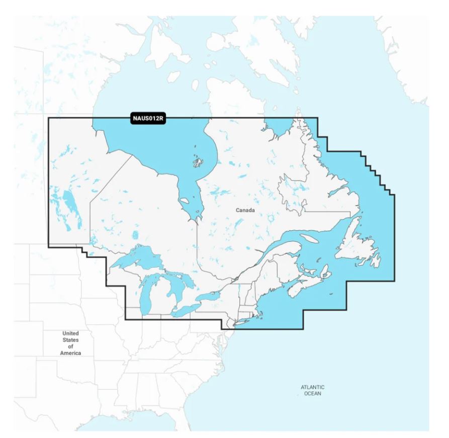
Navionics 010-C1466-30 Marine Cartography
Navionics 010-C1466-30 Marine Cartography is backordered and will ship as soon as it is back in stock.
A comprehensive, all-in-one solution, Navionics+ charts and maps combine clear, reliable coastal/inland content with advanced guidance features and compatibility with a wide range of chartplotter brands. Detailed coverage of the Atlantic and Pacific coasts, inland lakes and waterways of Alaska and Canada (except YT and NU). Coverage features the Aleutian Islands, Vancouver Island, Puget Sound, the St Lawrence River, the Maritime Provinces and the Grand Banks. Access detail-rich mapping of coastal features, lakes, rivers and more on a wide range of compatible chartplotters. Integrated coastal and inland lake content offers coverage for boaters worldwide. Downloadable high-resolution satellite imagery5 provides a realistic view of your surroundings — ideal for entering unfamiliar harbors or ports. Crystal-clear aerial and surface photos of ports, marinas, bridges, docks, boat ramps, dams and navigational landmarks provide a better sense of your surroundings above the waterline.
- Navigate With Our Best Offshore And Inland Lake Coverage For Your Compatible Chartplotter
- See It Your Way: Customize Your View With Various Chart Layers And Overlay Combinations
- With Your Provided 1-Year Subscription, Access Daily Updates Via The Navionics® Chart Installer Software
- Advanced Route Guidance Technology2 Lets You Navigate With Suggested Dock-To-Dock Routings
- Selectable Map Options Let You Highlight Shallow Areas, Adjust Contour Density Or Select A Fishing Range
- Access Detail-Rich Mapping Of Coastal Features, Lakes, Rivers And More On A Wide Range Of Compatible Chartplotters
- For Improved Fishing And Navigation, Up To 0,5 Meter Contours Provide A Clear Depiction Of Bottom Structure For Fishing Charts As Well As Enhanced Detail In Swamps, Canals, Harbors, Marinas And More
- Change The Way You View Navionics Charts To Focus On The Details That Matter Most To You: Highlight Shallow Areas, Adjust Contour Density, Or Select A Fishing Range
- Unique 3D Views Provide Additional Perspective, Both Above And Below The Water’s Surface, To Highlight Key Features And Aid In Situational Awareness
- Limited 1 Year Warranty
[This product can expose you to chemicals Including () which are known to the State of California to cause cancer and/or birth defects or other reproductive harm. For more information, visit www.P65Warnings.ca.gov]
Product Specifications
Product Specifications
| Compatibility | Chart Plotters (See Compatibility Chart) |
| Chart Coverage | Detailed Coverage Of Canada/ East And Great Lakes - Rivers And Coastal |
| Storage | On SD/ Micro-SD Card |
Additional Information
Shipping & Returns
Shipping & Returns
Shipping Charges
Shipping charges vary and are determined at checkout based on your shipping address. We ship via UPS and LTL Truck Freight for larger items with various expedited shipping options. Free Shipping is available to a local store where applicable.
-------
60-Day No-Hassle Returns
If you are not pleased with your purchase, simply return it for a full refund. To return an item, please contact us at 833-727-8784 or customerservice@partsvia.com and request a return authorization number.
Contact
Contact
Call us at 1-833-727-8784 or Email us at customerservice@partsvia.com.
We typically reply within 24-48 hours of your submission.


